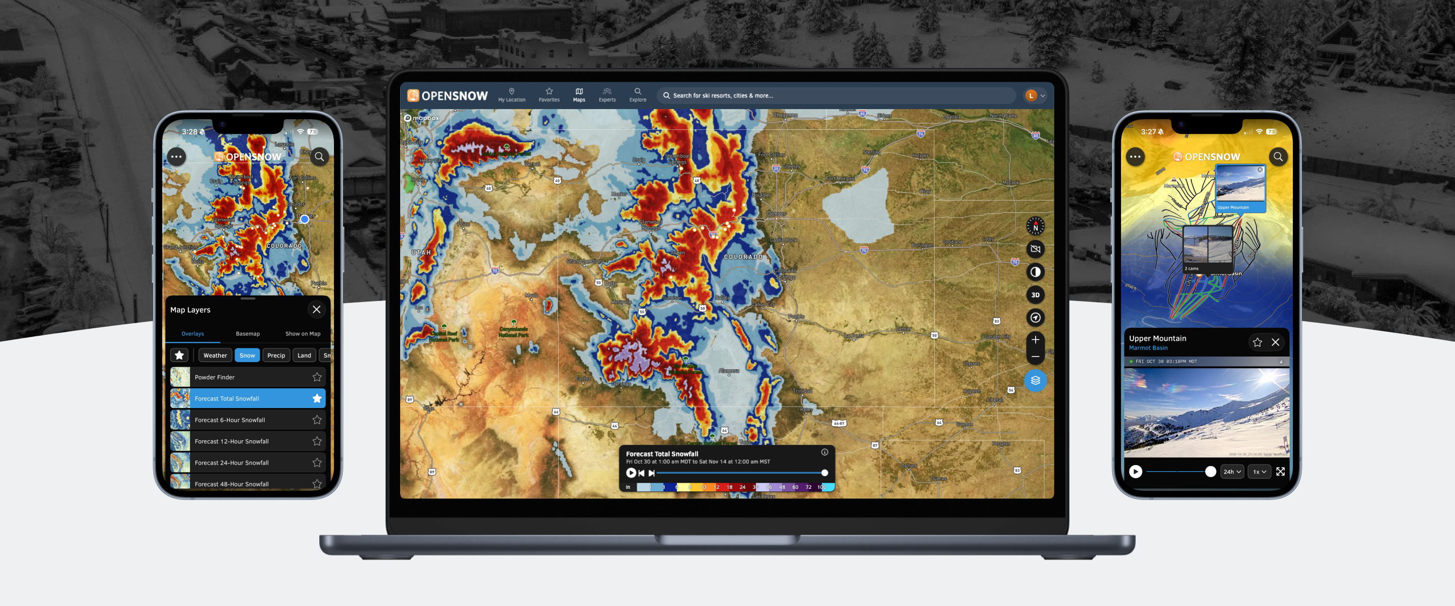
OpenSnow's interactive maps feature offers more than 20 weather and geographic overlays, from radar and snowfall totals to land ownership and wildfire smoke forecasts. However, navigating these layers was cumbersome, making it difficult for users to quickly find the information they needed.
I set out to simplify the experience by improving layer organization, streamlining access to frequently used layers, and creating a more flexible foundation for future features and functionality.
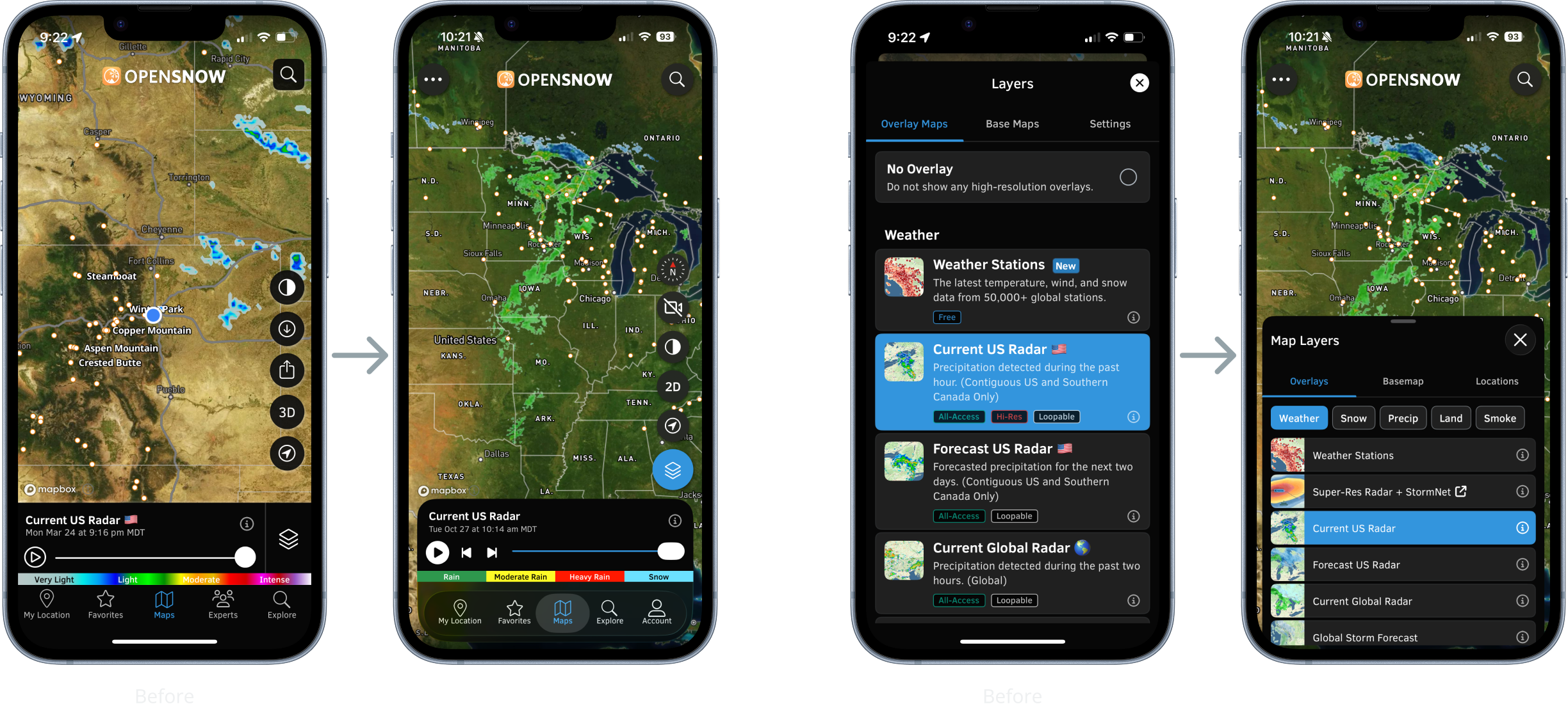
Previously, map layers were organized into long, difficult-to-scan lists that obscured the map while browsing. I redesigned the drawer to simplify navigation, maximize map visibility, and make exploring different layers more intuitive.
Grouped layers into categories and introduced new tabs, making it easier to find and switch between available overlays.
Reduced drawer height, removed lengthy descriptions, and simplified controls so users could preview layers without closing the drawer.
Updated the timeline scrubber to better align with iOS conventions and relocated the layer selector to give the scrubber more room and improve usability.
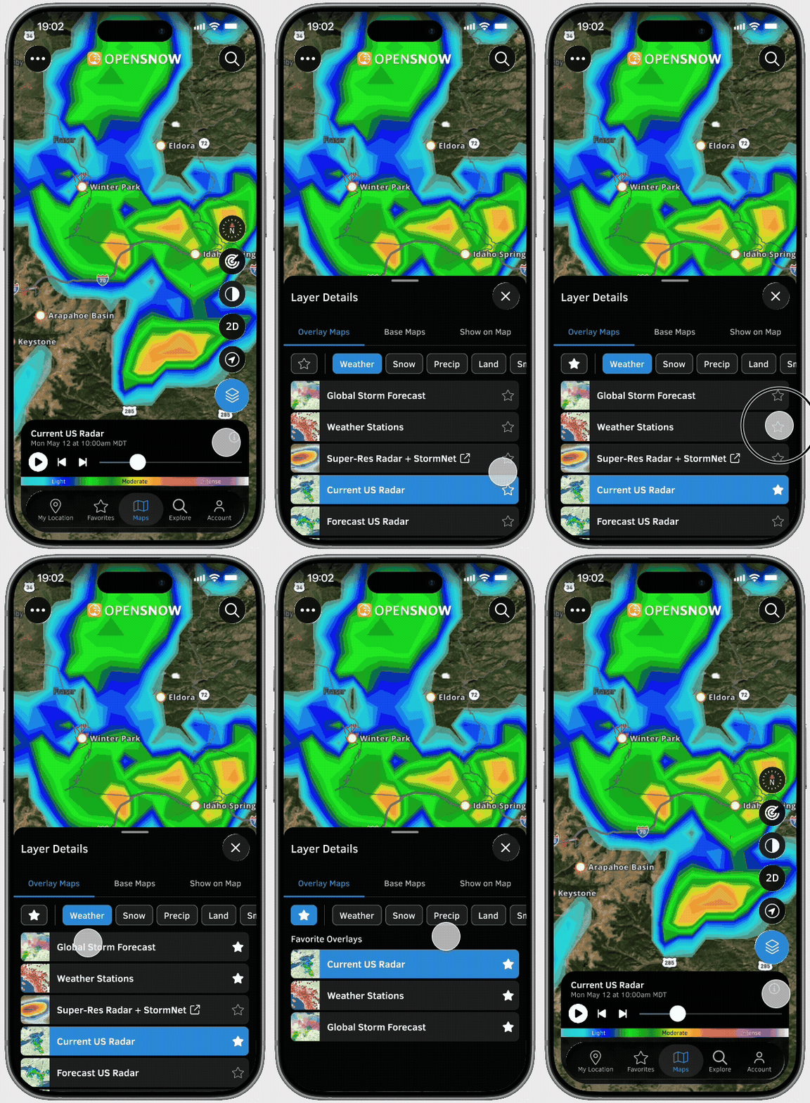
Research showed that most users regularly relied on just three or four map layers. However, these were often spread across different tabs, requiring unnecessary navigation to switch between them.
I introduced the ability to favorite layers, bringing frequently used overlays into a dedicated tab for quicker access and a more personalized mapping experience.
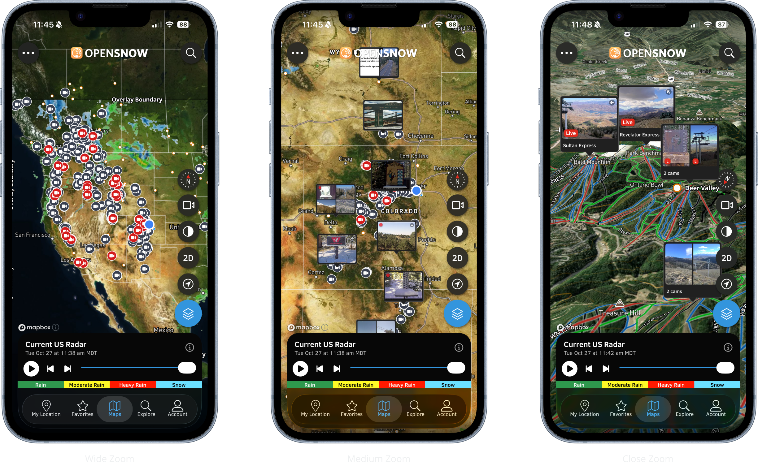
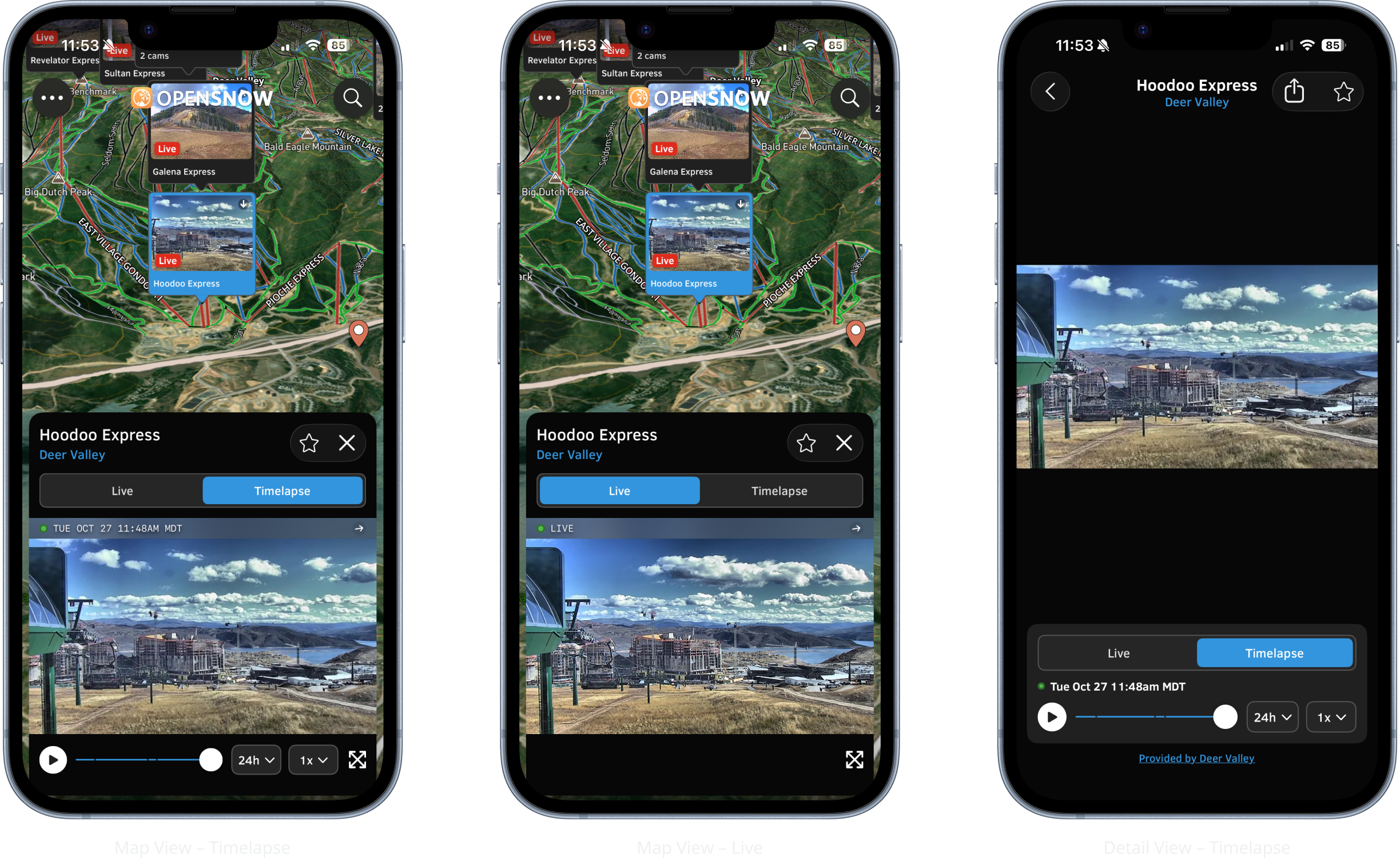
Previously, webcams were only accessible through individual location pages, making them difficult to discover and limiting their usefulness. Bringing webcams directly onto the map gave users a new way to explore real-time conditions alongside weather overlays, all within a single experience.
Designing this feature introduced a unique set of challenges, from managing camera visibility across zoom levels and clustering nearby webcams to creating intuitive preview and playback interactions. I worked closely with developers, using iterative design and prototyping to balance functionality, performance, and map readability.